

 Sign In
 Go to My Account
 Password Reset
 Email Preferences
 Order History
 Address Book
 Mailing List
 Wish List
 Sign Out


 828-963-6511
 directions
 Parking


 history
Nantahala Cullasaja Map


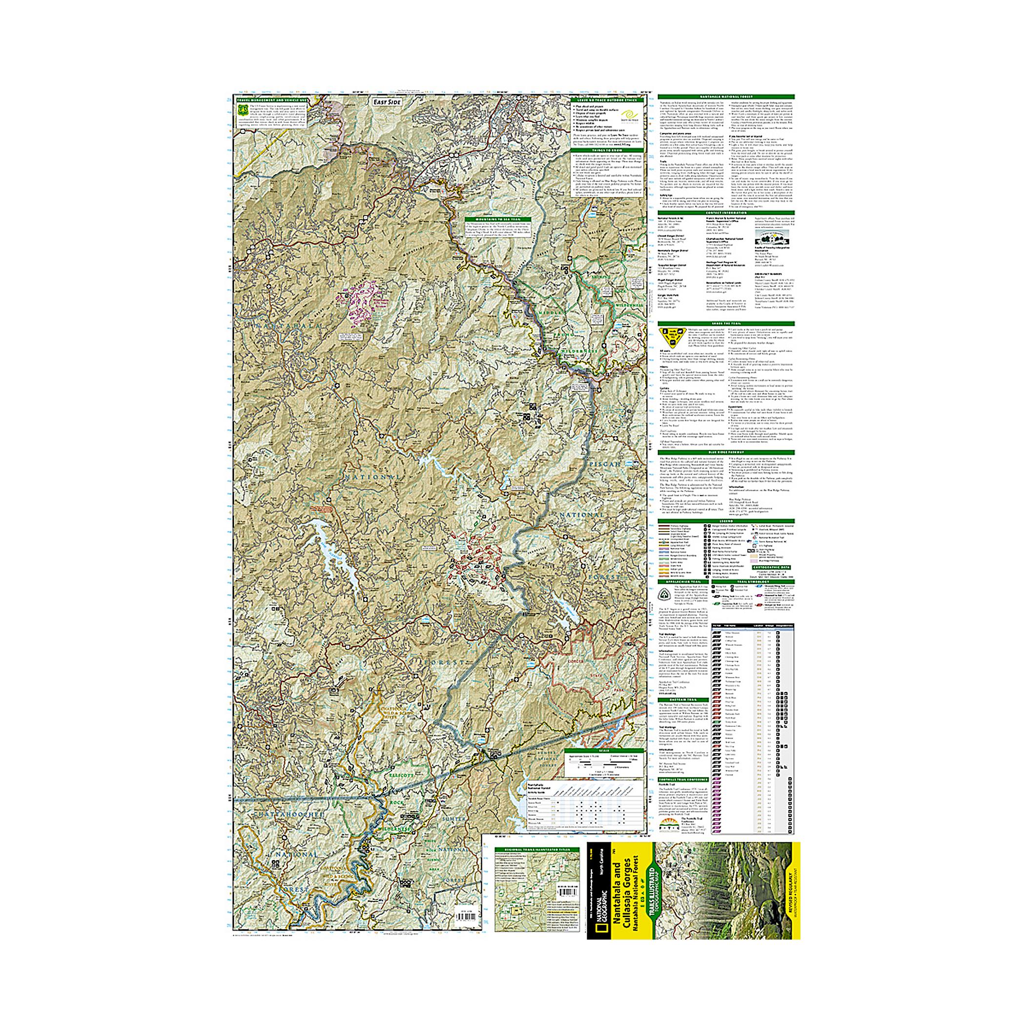
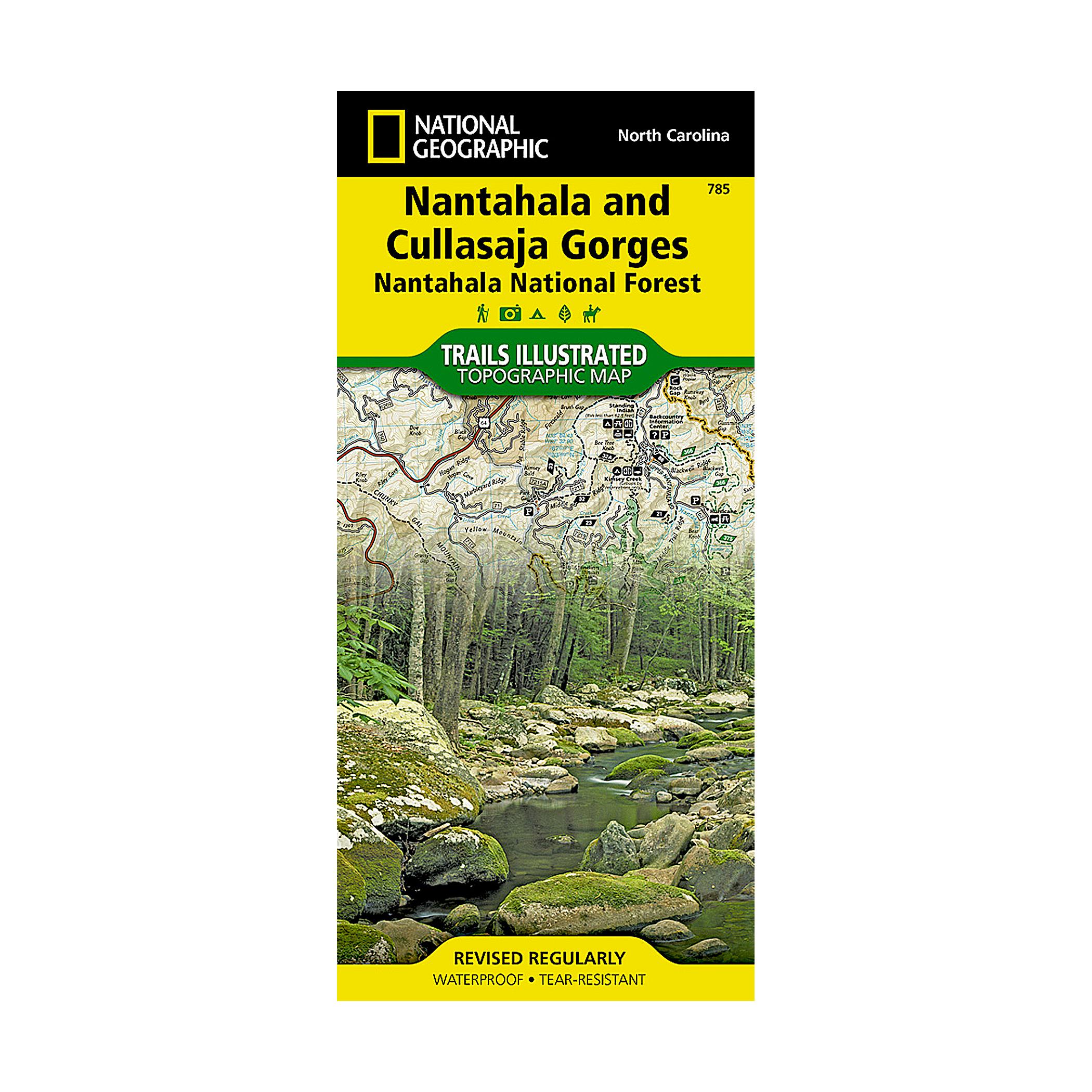
Nantahala and Cullasaja Gorge Maps
This Trails Illustrated topographic map is the most comprehensive and complete recreational map for the Nantahala & Cullasaja Gorges area of North Carolina. Coverage includes Nantahala National Forest - Nantahala & Cullasaja Gorges area. Towns: Franklin, Sylva, Highlands, Cashiers. Wilderness Areas: Ellicott Rock, Middle Prong. Scenic Drives: Blue Ridge Parkway. Other Highlights: Chattooga Wild and Scenic River.
Specs
- Folded: 4.25 x 9.25 inches
- Fully opened: 25.5 x 37.75 inches
- Scale: 1 : 70,000
the item is unavailable at the dimmed locations
We strive to provide the best customer service possible. When an item is shown as available in a location, we suggest calling ahead before driving to the store. Ask an associate to hold the item for your arrival to ensure its availability.
hours
mon9AM - 6PM
tue9AM - 6PM
wed9AM - 6PM
thu9AM - 6PM
fri9AM - 6PM
sat9AM - 6PM
sun11AM - 6PM
hours
mon10AM - 6PM
tue10AM - 6PM
wed10AM - 6PM
thu10AM - 6PM
fri10AM - 6PM
sat10AM - 6PM
sun11AM - 6PM
hours
mon10AM - 8PM
tue10AM - 8PM
wed10AM - 8PM
thu10AM - 8PM
fri10AM - 9PM
sat10AM - 9PM
sun11AM - 6PM
hours
mon10AM - 6PM
tue10AM - 6PM
wed10AM - 6PM
thu10AM - 6PM
fri10AM - 7PM
sat10AM - 7PM
sun11AM - 6PM
hours
mon10AM - 6PM
tue10AM - 6PM
wed10AM - 6PM
thu10AM - 6PM
fri10AM - 8PM
sat9AM - 8PM
sun11AM - 6PM
hours
mon10AM - 8PM
tue10AM - 8PM
wed10AM - 8PM
thu10AM - 8PM
fri10AM - 9PM
sat10AM - 9PM
sun11AM - 6PM
hours
mon10AM - 6PM
tue10AM - 6PM
wed10AM - 6PM
thu10AM - 6PM
fri10AM - 7PM
sat10AM - 7PM
sun11AM - 6PM
hours
mon10AM - 7PM
tue10AM - 7PM
wed10AM - 7PM
thu10AM - 7PM
fri10AM - 9PM
sat10AM - 9PM
sun11AM - 6PM
hours
mon10AM - 6PM
tue10AM - 6PM
wed10AM - 6PM
thu10AM - 6PM
fri10AM - 8PM
sat10AM - 8PM
sun11AM - 6PM

hours
mon10AM - 6PM
tue10AM - 6PM
wed10AM - 6PM
thu10AM - 6PM
fri10AM - 7PM
sat10AM - 7PM
sun11AM - 6PM

hours
mon10AM - 6PM
tue10AM - 6PM
wed10AM - 6PM
thu10AM - 6PM
fri10AM - 8PM
sat10AM - 8PM
sun11AM - 6PM